Annapurna Circuit Trek is one of our most special and exotic trek that we take pride in. The Annapurna circuit trek was regarded as one of the top 5 treks in the world prior to the road construction threatened its reputation. We have designed this special itinerary to revive its reputation by avoiding the road and including even more exotic and intriguing valleys of the restricted area of Nar & Phu, which has been opened only since 2003. After Nar Phu Valley we visit the world’s highest lake, Tilicho Lake at 4949m, which surpasses all superlatives when its deep blue water reflects the surrounding 7000m mountains.
Overview
Beginning with a couple of days hiking on the Annapurna circuit trail we reach Koto, from where, we enter into the restricted area of Nar & Phu valley in an off the beaten trail. The trek passes through narrow canyons and beautiful valleys of the Nar & Phu, where very few trekkers have explored. The expression “just me and the mountains” is in solidarity with the solace and serenity of this valley.
After a week exploring this exotic landscape with beautiful pine forests, stunning gorges and waterfalls, picturesque villages and ruined forts, we cross the Kang La, leaving behind Nar Phu valley, to join the Annapurna circuit trail.
Entering the Manang valley, we will immediately come across throngs of tourists which feels nice to socialize for a while, but it somehow steals the serenity of the adventure that we experienced along the Nar Phu Valley. Therefore we leave the highway at Manang and enter an even more fascinating valley leading to the Grand Barrier which is a massive 7000m mountain barrier, and to the world’s highest lake, Tilicho at 4949m. Then we cross the Mesokanto la pass at 5190m, which at any given comparison of beautiful scenery, surpasses the popular Thorung la by leaps and bounds. The Mesokanto la offers breath taking views of Tilicho Lake and soaring peaks of Annapurna II, III and Ganga Purna, Mt Manaslu range and the Chulus. Crossing the Mesokanto La, we leave the Manang valley and enter into another exotic valley of Mustang to end this fascinating dream trip.
What Makes this trip Special
- Explore restricted area of the Annapurna’s eco touristic destination
- Magnificent views of 3 of the worlds fourteen 8000m peaks- Mt. Manaslu, Mt. Dhaulagiri and Mt. Annapurna I and several surrounding dramatic mountains.
- Trek the restricted area of the Nar and Phu valley which was opened only in 2003
- Experience the time immortal cultures of the ethnically Tibetan Nomadic tribes.
- Camp at the breath takingly beautiful highest Lake in the world, Tilicho lake 4949m
- High mountain passes Mesokanto La (5190 m) and Kang-La (5322 m).
- Visit ancient monasteries, ruined fortresses along the part of the Trans Himalayan trail.
- Breathtaking views from the mountain flight from Jomsom, through the world’s deepest gorge.
Itinerary
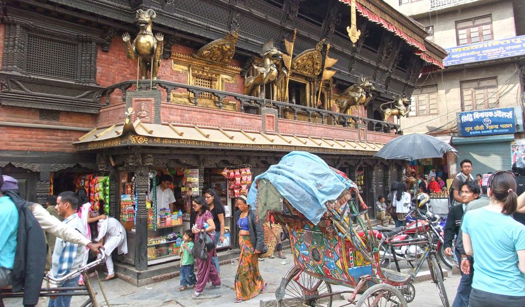
Once you reach KTM airport and finish with the immigration and custom formalities be prepared to confront the confusion outside the airport which is common in most of the south Asian countries. As you walk out of the Exit door into the passenger pick up area you will see hundreds of people with different sign boards in their hands, taxi drivers looking for fares, hotel touts looking for customers and porters trying to help with the luggage for tips. Please remain calm and do not walk out of the restricted area into the crowd straight away. Remain there and try to find the Hi On Life Adventures sign board. Once you spot it, walk straight to the signboard and identify yourself. From here we will take care of you.
When you arrive to your hotel you will be briefed about your activities and "do's and don’ts" while your stay in Kathmandu.
In the evening we will go for a traditional Nepali dinner at Kathmandu's finest Nepali restaurant to end the day.
After breakfast you will be taken for a half day city tour where you will be visiting some historical temples and monuments. You will end your sightseeing with a lunch.
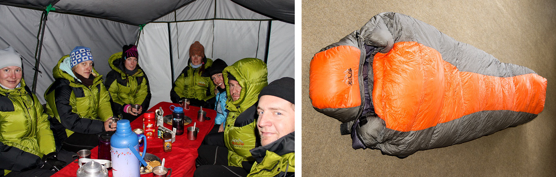
After your lunch you will be return to your hotel and your Group leader will give you your trek briefing and issue you your 'trek pack' consisting of a duffle bag, down jacket, sleeping bag, inner liner for your sleeping bag and rain poncho.
Your afternoon is free for you to do your packing and purchasing your last minute items for your trek.
Early morning drive towards west from Kathmandu, following the winding road over the valley alongside the Trishuli River brings us to a small bustling highway junction called Muglin. Here we cross a suspension bridge and leave the East West Highway and continue on the Prithvi Highway that connects Kathmandu and Pokhara. After the suspension bridge over the confluence of Trishuli and Marshyangdi, we drive alongside the Marshyandi River towards Pokhara until we reach a town called Dumre which is 148 Kms from Kathmandu. On a clear day, the mighty ranges of Annapurna, Ganesh and of Manaslu are intermittently in view. Here we leave the Prithvi Highway and turn North and drive 36 kms on a narrow road to Besisahar. It will take us approx. 5 to 6 hours from Kathmandu to reach Besisahar.
Besisahar is a fairly large bustling town with plenty of tourist lodges and restaurants. This used to be the starting point of the Annapurna Circuit trek before the construction of the road. From Besisahar we need to change our vehicle to a 4 wheel drive jeep and drive alongside the Marshyangdi River on a dirt road for 37 kms to reach Chyamje. It will be a tiring day with a long drive specially the rough road from Besisahar to Chyamje, so we take an early dinner and call it a day early.
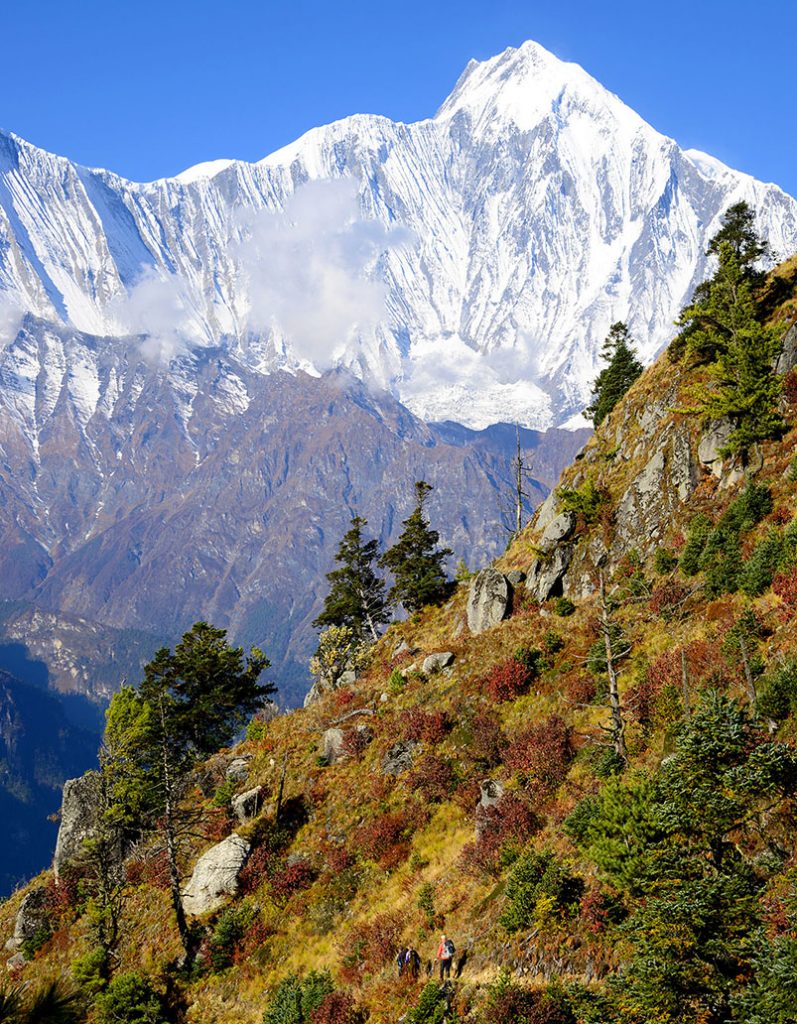
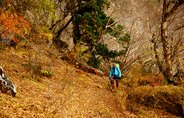
Right after we commence our trek after breakfast, we leave the jeep road and cross to the other side on a suspension bridge and start climbing stone stairways through a forest for about 2 hours with the river tumbling through a maze of large boulders. After reaching the top of the zig-zag climb, the valley suddenly widens out to reveal the village of Tal, which nestles amongst the fields of barley, wheat and potatoes. We have now entered the district of Manang.
We walk past the village along the bank of the river and cross a suspension bridge to meet the jeep road on the other side. An easy walk along the road passing several small restaurants and small Rainbow trout fisheries brings us to a village called Dharapani. This is the end point of the Manaslu Circuit trek. Here we stop for lunch. After lunch the trail leads through dramatic fir and pine forests. After an hour, we reach Bagarchap (2160m), the first village on the trek with typical Tibetan architecture. Here we may observe firewood stacked on the roofs in preparation for the long, hard winters. Excellent views of Lamjung Himal 6983m, Annapurna II 7937m, and Annapurna III 7555m, can be seen towards the west and Mt Manaslu 8156m, Peak 29 7871m, and Himalchuli 7893m, can be seen towards the East. There are many apple orchards in this village and around this area. Our lodge for the night is in the midst of the apple orchard.
We begin with a gradual climb steadily through a dense forest. There are beautiful waterfalls along the trail. After 3 hours walk we reach Timang where we stop for lunch. Again breath taking views of Mt. Manaslu, Peak 29 and Himalchuli can be seen from here. After lunch we continue through the coniferous forest to an amazingly beautiful village of Thanchok. It is an old Tibetan style village with beautiful terraced fields and apple orchards. After Thanchok, we again meet the jeep road and an easy trek for an hour reaches Koto. Koto is a small bustling town with several lodges and a police check post. Koto is a junction for the Annapurna Circuit main trail and the Nar Phu Valley trek. Restricted area permits are checked for Nar Phu Valley. We stay here for the night.
Today we start early, as there is a lot of distance to cover. Right after the check post we cross the Marshyangdi River and enter the remote valley of Nar & Phu through a narrow canyon.
We trek through beautiful pine forest following the Nar Khola in the canyon, past small cave shelters and pilgrims’ resting places called Dharmasalas. We stop at one of these pilgrims resting place in the forest for lunch. The trail is narrow which is cut through near vertical rock massifs in the canyon. Emerging from this narrow canyon, the trail passes under a wide waterfall. Suddenly the forest becomes thinner and the landscape wider. The last stretch into Meta involves climbing a steep hill. Meta lies on a big open cultivated field and consists of a few lodges, which are simple but clean and offer good meals.
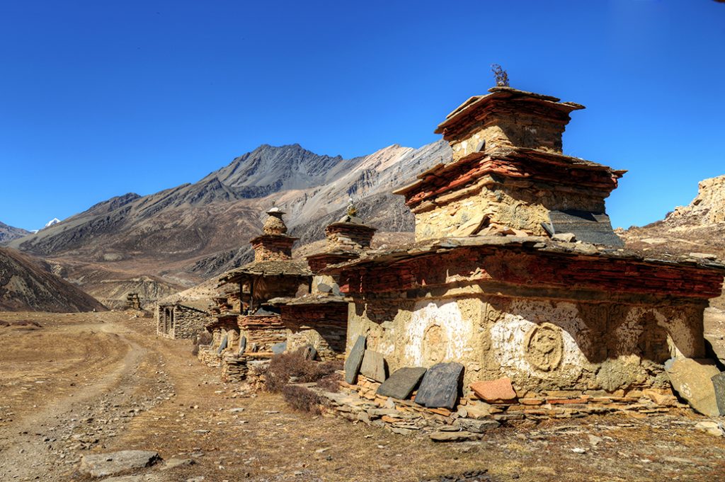
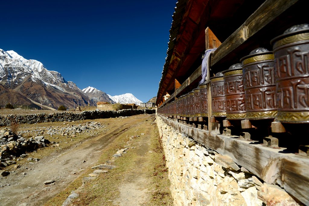
From Meta , the trail meanders along the ridge passing some of the unique, colorful Tibetan Buddhist chortens that Nar and Phu are famous for. The trail is easy following the contour and is marked by spectacular shapes of very old juniper trees and colorful bushes along the sides. This day in particular is very beautiful with huge snowy peaks to the East and dramatic arid landscape to the west and north. We stop at a small Khampa settlement called Chyaku. Chyaku is a large agricultural pasture where they grow barley and potato and keep goats and sheep.
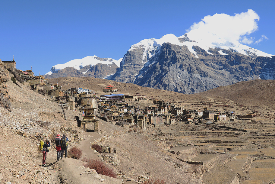
An hour walk from Chyaku brings us to another beautiful Khampa settlement called Kyang. Beautiful views of the Annapurna II, dramatic rock cliffs and charming Khampa settlement of the sheep herders make this place amazingly picturesque. After Kyang the trail enters a narrow gorge and is cut through near vertical rock massif. After about 2 hours trek through this scenic canyons and gorges, the trail climbs steeply through dramatic rock formations to the entrance of Phu. From here, we can see the villages of Phu, the old “dzong” (Tibetan-style fortress) and the remains of two ruined forts, impressively situated atop the flatlands before the village.
Phu is one of the remotest villages of the Himalayas. The history is dated back 900 years and numerous conflicts between the Tibetans and the people of Phu has been recorded. A 3 day trek from this village takes you to the Tibetan border. From here you can also enter the Kingdom of Mustang via Saribung pass.
Today we spend an acclimatization day in Phu. We will explore the tiny alleyways of the town where the villagers are seen spinning their yak and sheep wool, women weaving carpets from yak wool, pounding mustard seeds into a paste for oil, or go about their other daily chores. We will climb up to the top of the village for breathtaking views of Mt. Kang Guru and Himlung Himal. In the afternoon we will visit an ancient Bon monastery.
We will retrace the route back down towards Meta, but turn off just before reaching
Meta and descend steeply down to a fascinating bridge high above the narrow river cut gorge. From here we walk to the Nar Phedi monastery, which will be our accommodation for the night. In fact, the monastery is all that Nar Phedi consists of.
The rooms in the monastery are neat and clean. There is a small dining room enough for 15 people and next to it is the kitchen where we can watch them prepare dinner on a modest fireplace. At 5 pm they usually do a prayer ceremony, which we can witness. A small donation is expected for the maintenance of this beautiful place.
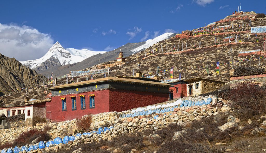
We begin our trek with a gradual climb, at times steep, winding up a hill towards Nar. We pass an array of wonderfully painted chortens on the way into the village of Nar. We arrive Nar at around lunch time. Nar is situated on the Northern flanks of the Pisang Peak. The village is situated on a large pasture and cultivated fields where they grow barley and potatoes. There is a beautiful monastery in the village. It is a very social and lively village where people are seen weaving woolen fabrics for rugs and blanket, working in their fields, small gathering of women chit chatting at the village water source an some busy with their daily chores. We will stay at a lodge next to the newly built monastery.
The trek is fairly easy and a very gentle climb on a vast almost flat valley bed. Spectacular views of Kang Guru is seen as a backdrop as we leave the village behind and Pisang Peak to the south. There are 2 tea shops just before we start climbing toward the pass. Here we will stop for the night to make the distance between Nar and Ngawal shorter.
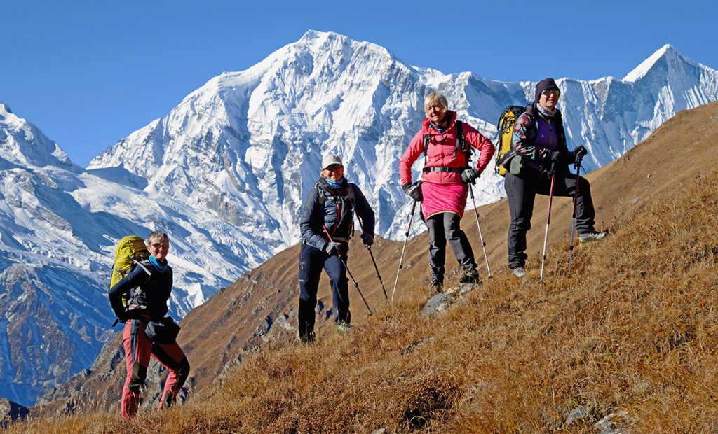
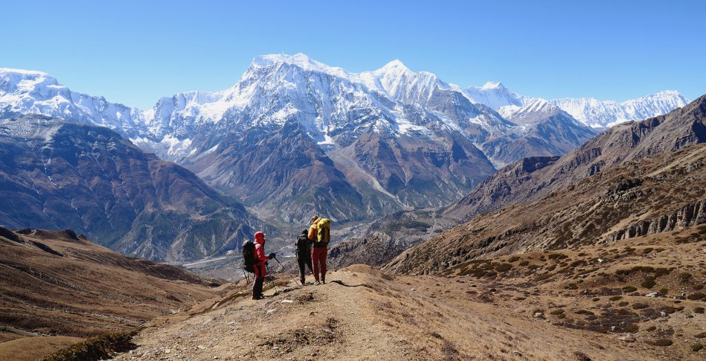
Today is a long day, so get up before sunrise and head towards the Kang La pass. The trail climbs gradually and not too steep in the beginning towards the pass. Before reaching the pass we climb steeply on a zigzag trail until we reach the top of the pass. From the pass there are fantastic views over Annapurna II, Gangapurna, and Tilicho Peak all above 7000m. The trail down starts off steep on a loose scree for about an hour. Then it gradually becomes less steep and we reach a beautiful meadow with views of the Chulu range. Here we stop for a picnic lunch and give rest to our tired legs after the steep downhill. There are beautiful rock formations along the trail and pass by Milerepa caves before we reach Ngawal, on the upper Pisang route of the Annapurna Circuit. Milerepas are Bhuddist are yogis and poets who renounce the world and live in caves for meditating and writing poems that inflicts the deeper meanings of life. We arrive Ngawal in the late afternoon and stay at a relatively modern and beautiful lodge with wifi, hot showers and comfortable beds and delicious food. It is a nice lodge to relax after a hard days walk.
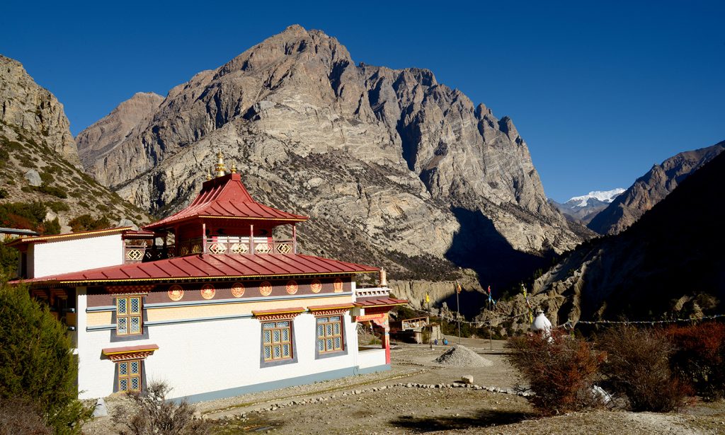
After an hours walk we reach Braga (3475m)perched high on the valley cliffs. Above the houses is a monastery, the oldest and most interesting in the area, estimated to be over 500 years old. From the village of Braga it is only a short walk to the village of Manang. The huge icefall of Annapurna rears over the village. Annapurna II and Annapurna III tower dramatically above the valley floor to the south-east, with Tilicho, RocNoir and the Grand Barrier to the west. Chulu West and East lie behind the village.
Manang is a major town of the region which is situated in the broad valley of the Marshyangdi River to the north of the Annapurna mountain range. It is also the district head quarter. There are many lodges, health post and even a movie theatre.
From Manang, we take a jeep to Khangsar which is about 10 kms and takes about 45 mins. After reaching Kangsar we start our walk, the trail leading up towards Siri Kharka 4060m where we stop for lunch. Breath taking views of Gangapurna Himal, Annapurna III dominates the southern skyline. After lunch, we pass a monastery and continue to Tilicho Base Camp.
Please note- since it is quite a long distance trek to Tilicho Base Camp, depending on various conditions, we might halt an hour or so early near a monastery where there are beautiful lodges.
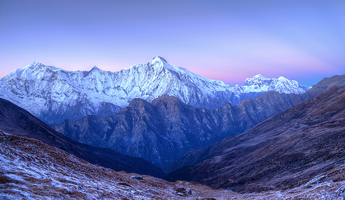
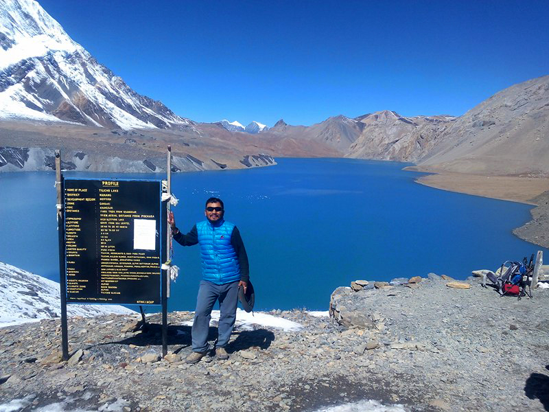
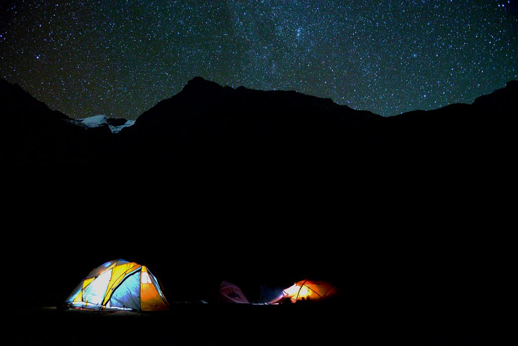
The trail is steep in the beginning, and then climbs gradually towards the lake. Plenty of Yaks can be seen grazing around here. The trail passes through the middle of a landslide area on loose scree. It is a very scenic trek passing amazing rock formations and awe-inspiring views of the mountains. O reaching the lake we get to witness the grandeur of the majestic mountains and their reflection on the lake. Tilicho lake is the highest large size lake in the world. At almost 5000m, this glacial lake is about 1 km wide and 4 kms long. The peaks of Gangapurna, Annapurna III and Tilicho’s Grand barrier soars up more than a couple of thousand meters form the lake. There is a lodge at the lake, but we will camp overnight here. The evenings are particularly beautiful if the weather is clear.
After a relaxing morning, enjoying the mountain views and the lake in the morning, we head for High Camp. The trail continues through loose scree and rocks and through rock slide areas. The climb is steady inclined. We reach our camp beside a big rock and halt for the night. It will be an early night and dinner will be served in the tent.
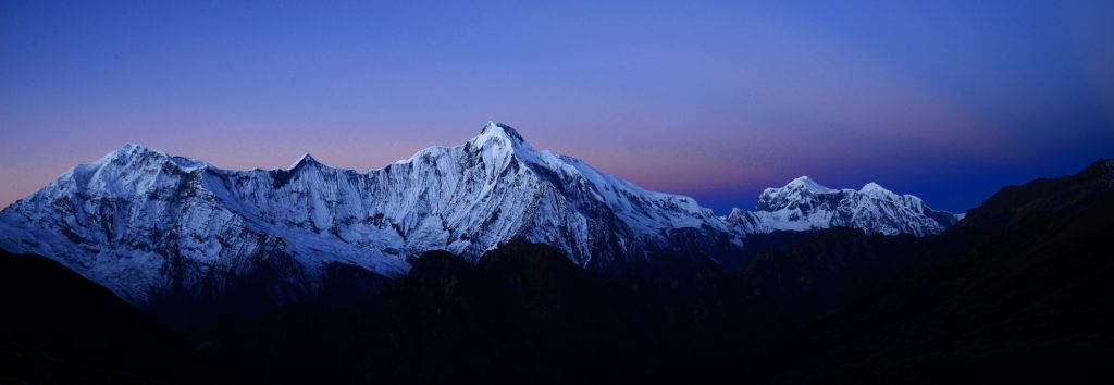
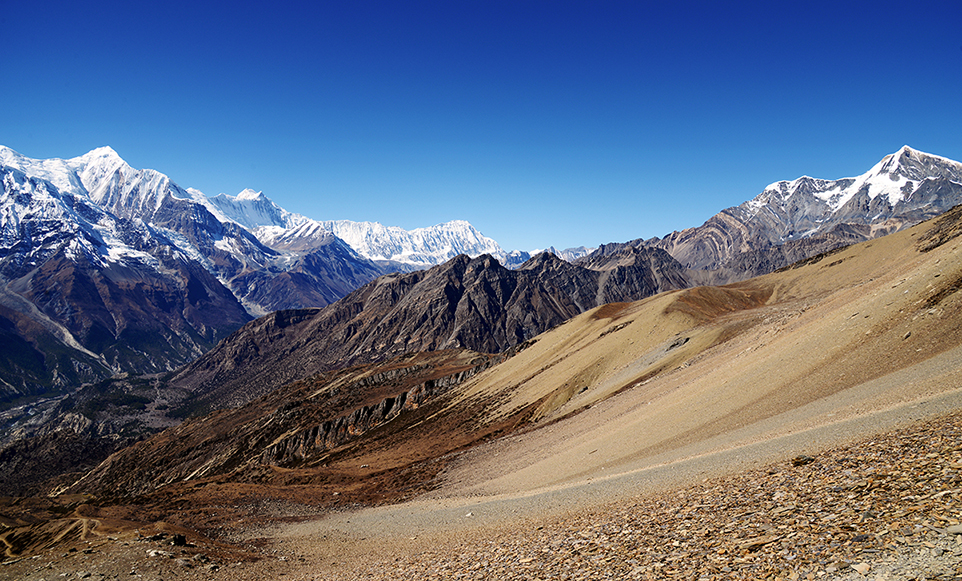
We leave the camp early to get the best views and to avoid high winds that usually picks up later in the day. The trek to the pass is a gradual uphill. We reach the pass in a couple of hours. The views are just breath taking. We can see Mt. Dhaulagiri and its range in the Western sky and Mt. Manaslu and Annapurna range in the East. Descending from the pass takes us down a steep zigzag trail on loose scree. We have to take this downhill very cautiously. If there is snow, we need to use fixed ropes. In worst case we take the alternative route which is 2 hours longer, but easier and safer. It is a continuous descend for 1500m to our camp at Yak Kharka, which is yak herder’s seasonal shelter. We spend another night in the tents here.
Today also we continue the descend but we leave the barren landscape and enter into more greener meadows and trees. The sight of Jomsom brings us to the reality that this fascinating dream trip is over and get ready to get back to the civilization.
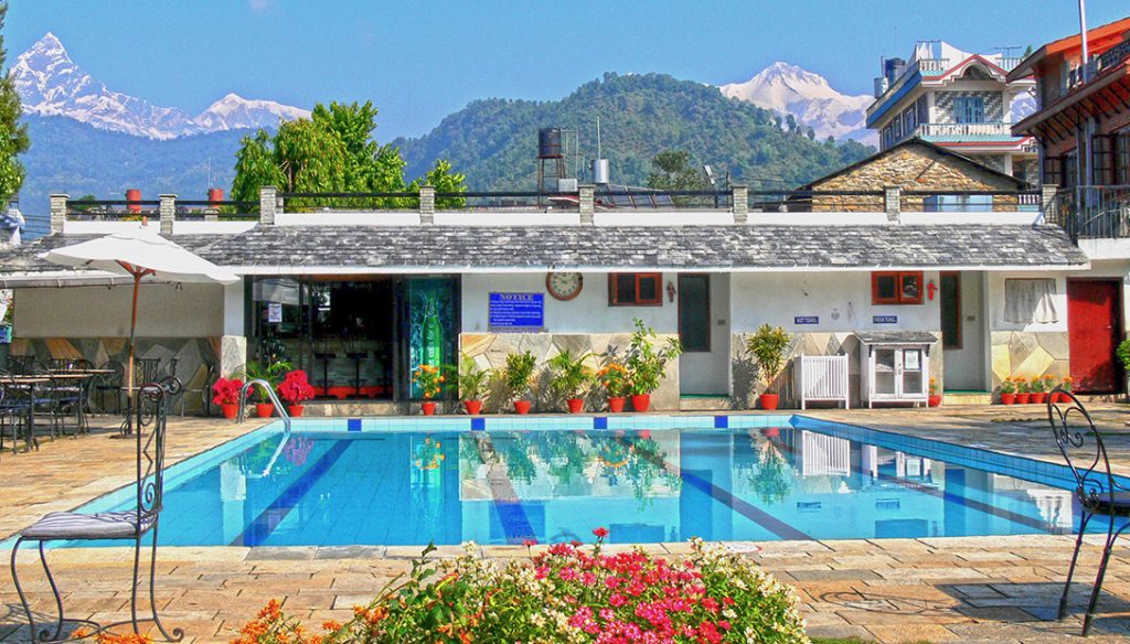
An early morning flight from Jomsom flies between the world’s deepest gorge with Mt. Dhaulagiri 8167m to the West and Annapurna I 8091m to the East. This 30 mins flight from Jomsom to Pokhara is one of the most scenic mountain flights in Nepal. We arrive early in Pokhara and check into our hotel. After a long shower and getting refreshed we can explore the charming and relaxing Lake Side of Pokhara which has numerous restaurants and shops. We can also just relax and enjoy the swimming pool at the hotel. In the evening we will eat at one of the best restaurants in Pokhara.
After breakfast we drive along the Prithivi highway passing the village of Dumre where we turned off from this highway on our drive to Besisahar at the beginning of the trek. From here we drive the same highway all the way to Kathmandu that we drove while coming in.
We arrive out hotel in the late afternoon. The evening is spent either with a farewell dinner of just take an early night after a tiring drive, and get ready for the final departure the next day.
Your Group leader will meet you at the hotel 3 hours prior to your flight time and drive you to Tribhuvan International airport for your departure.
Price Includes
- All internal transportation, in private vehicle.
- Services of English or/and Swedish speaking guide.
- Porter's and sherpa's assistance.
- 3 nights at Hotel Manaslu on bed and breakfast basis while in Kathmandu.
- Welcome dinner.
- 1 night at Hotel Barahi while in Pokhara.
- Half day guided Kathmandu Valley sightseeing tour with all entrance fees and lunch.
- Drive Kathmandu/ Besisahar/ Chyamje in private vehicle
- Drive Pokhara/ Kathmandu in private vehicle
- Flight Jomsom to Kathmandu
- Use of a personal trek pack consisting of a duffle bag, down jacket and sleeping bag with a fleece inner-liner
- All meals while on trek and Pokhara
- Afternoon tea/coffee service on arrival at the lodge
- Twin share accommodation in trekking lodges with shared .and toilet facilities
- Restricted Area permit for Nar Phu Valley
- Annapurna Area conservation fee
- Trekkers Information Management fee
- Staff insurance, tourist service fee and all taxes applicable as per state law.
Price Excludes
- Personal accident and rescue insurance. You must provide your own rescue insurance
- Mineral water, beer, soft drinks and extra tea/coffee outside of normal meal times.
- Private room accommodation in Kathmandu unless a single supplement is paid.
- Optional tips to guides and porters.
- Visa costs.
- Helicopter evacuation in the unlikely situation, although we do arrange for it and make the necessary documents so that you can claim from your insurance.
Map
About Nepal
Nepal a tiny country, nestled in the Himalayas between India and China, is one of the most diverse and fascinating countries in the world. Covering an area of only 147,181 sq. km, Nepal encompasses the world’s highest mountains and the deepest valleys as well as low elevation rain forest.Although the width of the country is only 200 km North to South, Nepal has the highest altitude variation of any country on earth, from 20m above sea level to 8 848 meters above sea level (Top of Everest).
The country is divided in to 3 elevation Zones viz. the low Terrain, the Midhill region and the High Himalayas, which contains 1/3 of the Himalayan range with 9 of the world’s highest mountains. This wide diversity of landform gives Nepal an incredible wealth of flora and fauna.Nepal is not only famous for its landscape but also renowned for the friendliness of its people. The people of Nepal are as variable and intriguing as the country’s geography. There are more than 37 ethnic groups with their own language and culture.Hinduism is the official religion, which the majority of the people practice. Many people throughout the country are Buddhist and the two religions have co-existed in harmony over the ages. A small number of people practice Christianity and Islam.
Nepal at a glance:
Longitude: 26’12’ and 30’27’ No
Latitude: 80 degree 4′ and 88 degree 12′ East
Population: 22 million
Capital: Kathmandu
Area: 147,181 sq. km.
The Annapurna
The Annapurna is a mountain range in the Himalayas, which lies in the North- Central Nepal. It is 55 km long range and the surrounding area is protected within an area of 7,629 square km under Annapurna Conservation Area Project (ACAP). It is the first and largest conservation area in Nepal. This region is home to several world-class treks, including the Annapurna Circuit.
The Annapurna Range includes one peak over 8,000 meters (Annapurna I- 8091m), thirteen peaks over 7,000 meters, and sixteen more over 6,000 meters. It is bounded by the Kali Gandaki Gorge on the west, the Marshyangdi River on the north and east, and by Pokhara Valley on the south.
Annapurna is a Sanskrit name that means “abundance of food”, but is normally translated as Goddess of the Harvests. The foot hills of this majestic mountains has a rich agricultural fertile land where the local inhabitants grow plenty of food crops form rice, wheat, barley, corn, potatoes to apples, oranges and plenty of vegetable.
Recommended preparation:
Stamina is essential, as walking days are long. We recommend previous trekking experience, preferably at altitude. Walking or jogging 45 mins to 1 hour for at least two times a week on undulating terrain or on a tread mill with inclined angle for at least 3 months prior to departure. Cycling is recommended. Long day hikes on weekends with a daypack in variable weather conditions is also recommended.
A Day On Your Trek
Although each day is different, considering the weather, general pace of the group and length of the days walk, in general your day begins with a wake up tea at around 6 to 6:30 in the morning. You will then be provided with a bowl of warm water for washing. Then you will need to pack your duffel bag and your daypack and come to the dining room for breakfast.
After breakfast we will hit the trail and usually walk for about 3 to 4 hrs before we stop for lunch. We will give you about an hour and a half rest during lunch, which will also give enough time for the staff to prepare lunch, wash dishes and have their lunch and pack. Usually after 3 to 4 hrs of walking we finish the days walk by 4 PM. Tea/ Coffee and snacks will be served on arrival to the camp. Your Group Leader will often organize side trips in the afternoon. Your dinner will be served around 7 PM.
Food and water
The cook and the kitchen crew prepares hot food which is normally a very balanced diet comprising of fresh vegetables and breads, to pastas and sandwiches and occasionally even cakes and pizzas. Breakfasts are usually bread eggs and cereals, and lunch and dinner are a three course meals. We make sure that you get the required amount of carbohydrates and proteins and vitamins as you burn a lot of calories walking uphills, so plenty of vegetables, canned meat and fish and eggs and cereals are carried.We provide boiled and treated water 4 times a day.
High Altitude
On this trek you will be going up to 5120m, so it is very important to understand the affects of altitude. The greatest provocation is going too high too fast. Hi On Life’s itinerary has been carefully designed to minimize the effects of altitude. We ascend slowly and surely allowing enough time for safe acclimatization.
Headaches and breathlessness are common at altitude which in itself is nothing to worry about. In rare cases, this may worsen to Acute Mountain Sickness (AMS), so a close watch is kept on all trekkers by the group leader who is trained to recognize the symptoms of AMS which are severe headaches, nausea, lethargy, loss of appetite serious breathlessness even at rest. If any trekkers show such signs they will be descended to relatively lower and safer altitude. The Group Leader’s decision on evacuating such person to a safe altitude is final. Do not medicate yourself without first informing your group leader. Going to altitude slowly with adequate rest and adequate intake of fluid (3 to 4 litres per day), you will most likely have no problems apart from breathlessness on hills which is completely normal as the percentage of Oxygen in the air is relatively lower to that at sea level. The most important thing is not to worry about altitude because our team is there to take care of you.
Staff
Group leader: your most important member of your staff. Our Group leaders are highly trained in all aspects of the trek, conservation, first aid specializing on altitude sickness, emergency procedures and have extensive knowledge of the natural history of the area.
Sirdar: His job is to manage and organize staff duties, select and organize campsites. He is responsible for the actual operation of the trek.
Sherpas: Their job is to lead your way and distribute equal loads to the porters and also help clients and other staff when need arises.
Porters: They are responsible to transport your duffle bags and their job finishes once they reach the designated lodge. Our porters are provided with Gore-Tex suits, trekking boots, gloves, hats, socks, snow gaiters and snow goggles. Most importantly, we regulate them on a 25 Kg carrying load. Our clients can therefore feel comfortable knowing that our porters are working in a good humane condition.
Weather
Oct/Nov and March/AprilOn the trek at lower altitude (1500m to 2500m) during daytime the Max temp can be around 22C to 25C and the Min temp can be 8C to 15C.At mid altitude (2500m to 3500m) during daytime the Max temp can be around 15C to 20C and the Min temp can be 2C to 8C.At higher altitude (3500m to 5500m) the daytime Max temp can be between 5C to 12C and Min temp can be between -4C to 2C
Recommendations for things you should bring:
- Water bottle: 3 bottles min 1 liter each, should be able to hold hot water)
- Day pack: medium size 35-40 liters
- Sunglasses: Poloroid/ UV protection 2-4
- Duct tape: Small roll for emergency fixing of torn jacket/ sleeping bags etc.
- Stuff bags: Small stuff bags or plastic bags to organize you duffle bag
- Money belt
- Toiletries: Your essentials. We provide toilet papers
- Towel: Quick dry travel towel
- Torch: Preferably head lamp
- Penknife
- Disposable lighter
- Sewing kit
- Medical kit: As per your prescriptions. It should be noted that the group leader will be carrying a first aid kit.
Optional
- Walking sticks ( highly recommended)
- Cameras
- Knee guard for those with bad knees.
- Daytime snack (chocolates/ dry fruit trail mix)
Clothing
- Trousers: 2 lightweight for easy walking and 1 warmer for colder days preferable wind/water proof, 1 stretchable running trousers
- Shorts: 1 (Not too high cut revealing ones)
- T-shirts: 2 light cotton or preferably polypropylene
- Full sleeves T- shirts: 2 preferably poly propylene or wool.
- Hats: 1 Sunhat and 1 woollen one for colder days
- Buff (cover for your mouth and keeps your neck warm)
- Gloves: 1 warm woollen/ fleece and 1 medium weight Gore-Tex
- Thermal underwear: 2 pair light weight tops and trousers, preferably woollen, and 1 pair medium weight
- Socks: At least 4 pairs (both thin and thick woollen ones)
- Jackets: 1 fleece/ wool and 1 Gore-Tex wind/waterproof. Please note that we provide down jackets.
- Walking boots: Preferably waterproof
- Gym shoes/sandals For evenings
Healthy and trouble free holiday
There are no compulsory vaccinations required for entering Nepal. However please consult a doctor for vaccination against Typhoid, Meningitis, polio, and hepatitis. If you have special dietary requirements or allergies, please through your agent, give us a list of what you can and can’t eat so that we can provide proper food for you. If you are undergoing a course of prescription medicine, please ensure that you have sufficient supplies for the entire holiday. Some types of drugs including antimalarias have side effects at high altitude; therefore please consult your doctors regarding these drugs. The places you trek are mosquito free and there has been no report on malaria in Kathmandu for the past couple of decades.
Insure yourself:
We highly recommend you to take a comprehensive Personal Travel Insurance before leaving home. This should cover for your loss of baggage, airline delays, sickness, and accidents. And it should also cover you for Emergency Helicopter Evacuation.
Money Matters
The ideal currency to bring with you is US$ or Euro. You can exchange them in Kathmandu. You can also draw money from ATM machines in Kathmandu.
In Kathmandu: Each meal will cost around 4 to 7 US$ + drinks. Plus 10 to 20 US $ for your taxis if you wish to go around the city.
On trek: you will need around 5 to 7 US$ per day. This money is for your hot showers, chocolates, soft drinks and beers etc and also for small donations in the monasteries.
Tipping
Although tipping is entirely optional and personal matter the following is recommended as a guideline
In Kathmandu: for bellboys, waiters and porters 50 to 100 Nepali Rupees
On the trek: At the end of the trek it is a customary to tip the field staff. The recommended amount is 100-120 US$ depending on group size. The Group leader will collect the tip and then split it between the staff and put it in envelops so that the trekkers can give it to the staff during the “Farwell Ceremonies”. Please note- the Group Leader is not included in this tip. If you want to tip the Group Leader, you can do it when you come back to Kathmandu.
Some Do’s and Don’ts
Nepalese people treat visitors as special guests. Although they will never rebuke you publicly for unknowingly offending them, we must consider their culture.
While in Nepal please observe the following:
- Full or partial nudity is not accepted.
- Over display of affection between men and women, especially in temples and monasteries are discouraged.
- Please remove your shoes before entering monasteries and temples.
- Never point the soles of your feet at a person or shrine.
- Many Hindu temples are closed to non-Hindus. Please ask before entering.
- Locals walk around the Mani walls and Stupas in a clockwise direction as a respect and they expect you to do the same although it is not compulsory.
- Please ask before taking pics of a person or his/her child
“TODAY IS YOUR DAY! YOUR MOUNTAIN IS WAITING, SO… GET ON YOUR WAY!”
DR. SEUSS